


Tap any icon on the map to uncover fascinating facts!
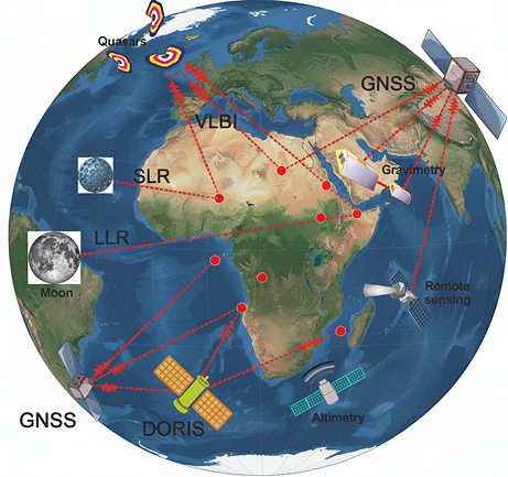
LLR
(Lunar Laser Ranging)
A technique that measures the precise distance between Earth and the Moon by timing laser pulses bounced off reflectors on the lunar surface. It is used to test theories of gravity and study the Earth-Moon system.
VLBI
(Very Long Baseline Interferometry)
Uses a global network of radio telescopes to observe distant quasars, providing a stable reference frame to measure tectonic plate motion and Earth's orientation in space with extreme precision.
GNSS
(Global Navigation Satellite System)
Uses a global network of radio telescopes to observe distant quasars, providing a stable reference frame to measure tectonic plate motion and Earth's orientation in space with extreme precision.
SLR
(Satellite Laser Ranging)
Measures the distance to Earth-orbiting satellites by timing laser pulses bounced off them. It is essential for determining precise satellite orbits, Earth's gravity field, and the center of mass of the Earth system.
DORIS
(Doppler Orbitography and Radiopositioning Integrated by Satellite)
A system where a satellite measures the Doppler shift from a global network of ground beacons to determine its own orbit with high accuracy. It is critical for satellite altimetry missions that measure sea level.
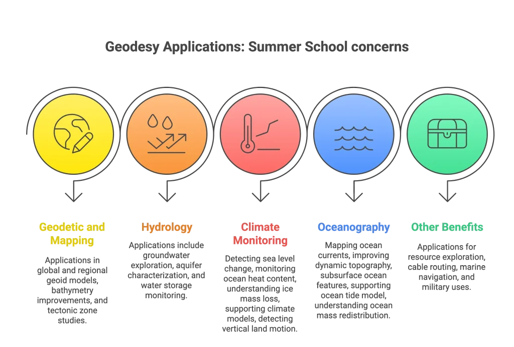
Remote Sensing
The science of acquiring information about the Earth from a distance, typically from satellites or aircraft. It is used to monitor land, oceans, and atmosphere, including applications like mapping deforestation, measuring sea surface temperature, and tracking weather patterns.
Satellite Altimetry
A specific remote sensing technique that uses radar pulses from a satellite to measure surface height with centimeter-level precision. It is the primary tool for measuring global sea level rise, ocean currents, and the changing height of ice sheets.